Import a GPX file

Niagara Falls trails

Click on a trail to view its statistics, map and profile.
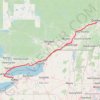
Québec - Montréal - Saint-Laurent River - Lake Ontario - Niagara Falls

Canada > Quebec > Urban agglomeration of Québec > Quebec

#Bike #Ontario

Distance: 1,078.4 Km • Elevation gain: 4,804 m • Maximum elevation: 209 m

Toronto - Niagara Falls

Canada > Ontario > Old Toronto

Lake Ontario. #Hiking #Loop #Ontario #Toronto #Niagara

Distance: 293.9 Km • Elevation gain: 1,500 m • Maximum elevation: 201 m

Niagara Falls - Hamilton

Canada > Ontario > Niagara Region > Niagara Falls

#Bike

Distance: 84.1 Km • Elevation gain: 537 m • Maximum elevation: 209 m

Town of Niagara Veterans Park boardwalk and nature trails

United States > New York > Niagara County

Distance: 5.8 Km • Elevation gain: 24 m • Maximum elevation: 195 m

Gear up for your next adventure:

🥾Hiking Boots - Sturdy boots providing ankle support and traction on rugged trails
❄️Traction Ice Cleats - Slip-on spikes for icy trails and winter hiking
🗺️Topographic Maps - Detailed maps to explore trails, mountains, and wilderness areas
🥾Trail Hiking Socks - Comfortable socks to prevent blisters and fatigue
🔭Compact Monocular - One-handed bird watching and trail spotting

As an Amazon Associate, this site earns from qualifying purchases at no extra cost to you.