Import a GPX file

Fletcher Peak via Wildhorse Ridge trails

Click on a trail to view its statistics, map and profile.
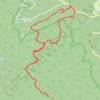
Fletcher Peak via Wildhorse Ridge

United States > Nevada > Clark County > Mount Charleston

Distance: 11.2 Km • Elevation gain: 688 m • Maximum elevation: 3,115 m

Gear up for your next adventure:

💡LED Headlamp - Hands-free illumination for night hiking and camping
🔥Camping Stove - Portable stoves to cook outdoors with ease
💡LED Camping Lantern - Illuminate your campsite with long-lasting lanterns
🚲Heavy Duty Bike Lock - Secure your bike at the trailhead or during stops
🧰Multitool Knife - Compact and versatile tool for outdoor use

As an Amazon Associate, this site earns from qualifying purchases at no extra cost to you.